
The Ultimate Southern Kimberley Expedition Cruise Guide
Written by expedition guide Jackson McReady
The Kimberley coast is not a line on a map but a living edge where continent and ocean negotiate, tide by tide, who will hold the shape of the world by morning. From Broome to Wyndham, from the shallow roar of the Horizontal Falls to the quiet, slate-black depths of the King George, this is a shoreline written in red rock and restless water. Your journey can be experienced in two movements: south and north, each with its own pulse, its own palette of sound and story. In this expedition guide, we’ll voyage through the stunning south. You can also read my Ultimate Northern Kimberley Expedition Cruise Guide to give you an idea of where, when and how you want to explore one of the world’s most breathtaking regions.
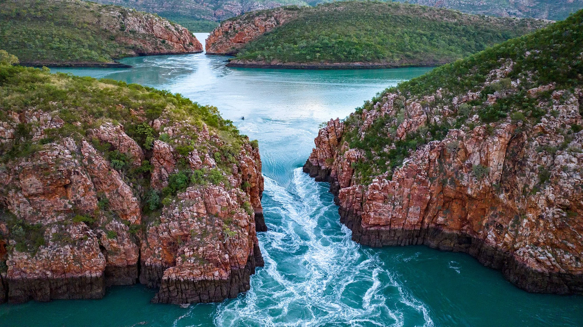
Horizontal Falls, the Kimberley
Southern Kimberley
Most Kimberley voyages either begin or end in Broome, and the southern coast is where the country first starts to loosen your grip on the ordinary. This is the shoreline people think they know from photographs – camel trains drifting along at sunset, rust-red bluffs meeting a milky turquoise sea, the dizzying geometry of islands and tides in the Buccaneer Archipelago seen from above. Yet the moment you leave the last streetlight behind and feel the vessel lean into the open water, you realise those images are only the front cover. Between Broome and the Mitchell Plateau, the coast is rewritten twice a day by some of the largest tides on Earth, and what seemed like a static landscape reveals itself as a moving, breathing entity.
The southern coastal Kimberley is a gateway in the truest sense: once you pass through, the old measures of distance and time begin to fall away. Days stretch and soften, not because there is less happening, but because everything is happening on the scale of tide and rock and sky. High water lifts you quietly over reef tops and through narrow, secret channels; low water pulls the ocean back like a curtain, exposing sculpted platforms, pale sand tongues and the dark ribs of Montgomery Reef as they rise into the light. You start to plan your hours not by the clock in the wheelhouse, but by the subtle signs in the water and along the shore.
When to go, and how long to stay on the southern coast, will shape the character of your entire expedition. Most southern-focused micro-cruise expedition itineraries run season-round and span anywhere from a concentrated 4-day “highlights” voyage out of or close to Broome, to 8-11 days that carries on to the Mitchell Plateau, where guests fly in and out as their expedition starts or comes to a close. Our personal favourite is our two-week expedition that continues past the Mitchell Plateau where the southern story hands over to the great northern rivers, joining both the north and south Kimberley into a single expedition. Shorter trips give a vivid taste of islands, reef and tides; longer journeys allow the quieter anchorages, the changing light and the rhythm of the sea to do their slower work on you.
The most dramatic waterfall volume in both the north and south comes at the tail end of the wet season, from February through to April–May, when creeks and falls around Talbot Bay, Doubtful Bay and Camden Sound are flushed with recent rain. Later in the dry, as the country exhales and the falls soften, the focus shifts: the water warms, the air clears, and days are increasingly shaped around swimming in sheltered pools, hunting for barramundi along mangrove-lined creeks, and watching humpback whales migrate under the clean, amber light of dry-season afternoons.
“Down here on the southern coast, you don’t arrive at ‘wilderness’ so much as slowly remember it. Each tide strips away a little more of your old life, until you’re left with sky, water, and the sense that the land has been watching you for a very long time.”
There are many ways to taste this edge of the world, but they do not all tell the same story. Some travellers arrive by air and spend a single fierce day skimming across the maze of islands, dropping into the roar of the Horizontal Falls before flying home again with salt still drying on their faces. It’s an exhilarating glimpse, like opening a book at random and reading one dramatic page. Others choose a slower passage: a multi-day voyage out of Broome that follows the curve of the coast into the island-strewn sweep of the Buccaneers, through the throttled energy of Talbot Bay, and onward to the “rising” Montgomery Reef and the sheltered, story-rich inlets of Doubtful Bay and Raft Point. Over a week or more, the famous postcards become waymarks in a much deeper journey.
Here, the coast introduces itself place by place. Broome, with its pearling ghosts and long, gleaming tidelines. The lonely sand cays and booming rookeries of the Lacepedes. The Bay of a Thousand Islands where water races and eddies between ancient bones of rock. The Horizontal Falls, where the sea forgets how to behave. Montgomery Reef, slowly lifting itself from the ocean’s skin. The quiet green corridors of Doubtful Bay and Red Cone Creek, with waterfalls tucked into their sandstone folds. And above them all, the art and stories of Raft Point and Bigge Island, reminding you that this “wilderness” has been carefully known and cared for long before any expedition vessel traced its way along these shores.
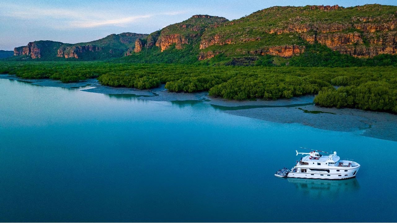
Hunter River, the Kimberley
From Broome to the Prince Frederic Harbour
The southern coast is the great threshold, where most travellers first encounter the Kimberley’s long horizons. The further you travel from Broome, the more the familiar world falls away, replaced by a coast that feels newly made each tide. It is a place where light, water and rock are constantly re-arranging their conversation, and where every bay seems to hold an older memory than the last.
Broome, Cable Beach & the open door
Broome is the soft front step to a very hard country: camel silhouettes at sunset, pearling history, palms rattling in the sea breeze. Yet even here, the tides already hint at what lies ahead, sweeping in and out with a force that makes harbours breathe and sandbars appear and vanish on a single walk along Cable Beach. This is where guests first feel the rhythm that will govern the rest of their voyage – the slow, deliberate inhale and exhale of the Indian Ocean.
Buccaneer Archipelago & the island maze
North of Derby, the coast fractures into the countless islets of the Buccaneer Archipelago. From the deck, they look like scattered vertebrae of drowned giant ridgelines protruding from turquoise water. Tidal currents wrap each headland in ropes of whitewater, and even the smallest rock seems to cast a long shadow in the glassy morning light. To travel here is to feel the chart, not the road, beneath your feet.
“I’ve watched guests go quiet as we slip into the islands. Not because there’s nothing to say, but because you realise words are suddenly clumsy things compared to these tides.”
Horizontal Falls & the tidal power

KQII at Montgomery Reef, the Kimberley
At Talbot Bay, time accelerates. The Horizontal Falls are not a waterfall in the ordinary sense but a throat in the rock where sea and tide argue loudly. Water rams itself through twin gaps in the sandstone, surging and foaming, changing direction as the tide reverses: one moment a furious river, the next an inward rush as if the ocean has decided to reclaim itself. Out here, “sea level” is a polite fiction. The Kimberley reminds you that even the horizon is negotiable.
Montgomery Reef & the rising stone
Further east, Montgomery Reef performs one of the great illusions of the Australian coast. As the tide drops, the sea seems to fall away from beneath the vessel, and the reef begins to lift itself, slow and inevitable, into the air. Cascades pour from its flanks like lace curtains, and narrow channels become quicksilver highways for turtles, rays and reef sharks hunting in the shallows. It feels less like watching an ecosystem and more like watching a planet breathe.
“If you stay very still at Montgomery, you can hear it: the crackle of water over rock, the exhale of turtles, the wingbeats of birds that have followed this tide line for millennia. It’s like being allowed into the engine room of the Earth.”
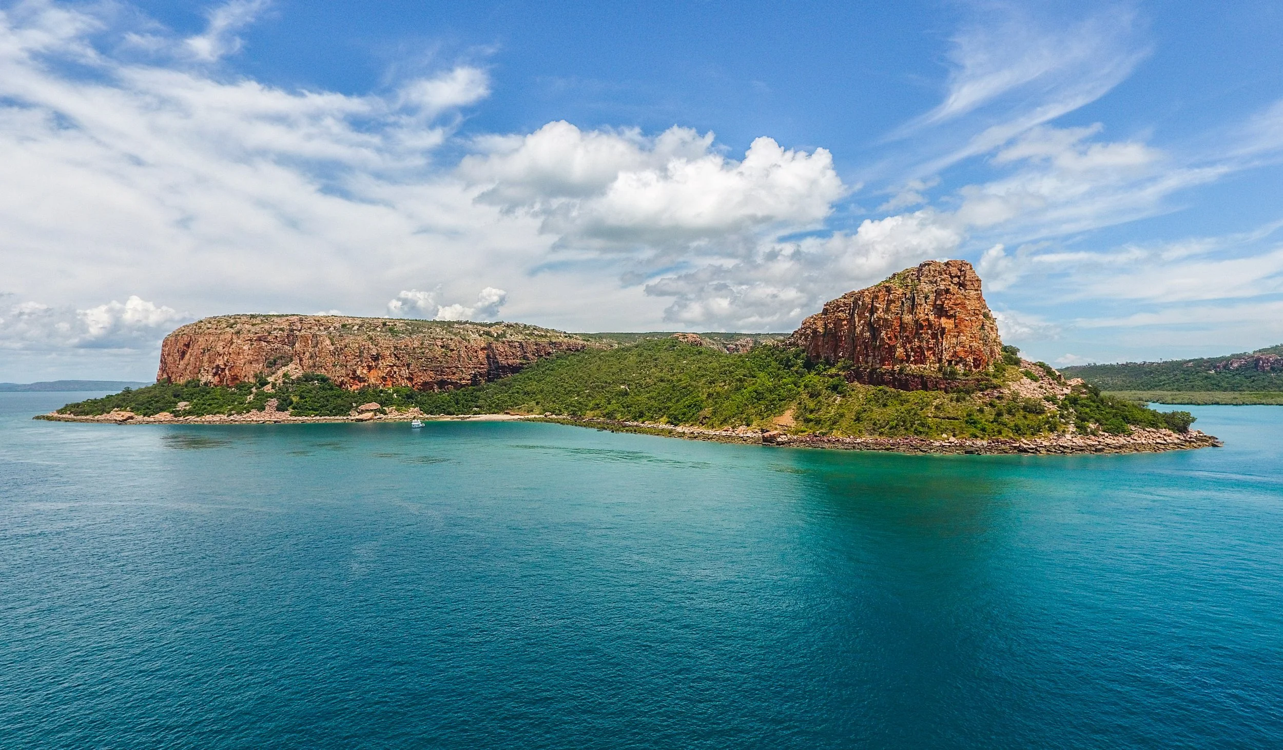
Raft Point, the Kimberley
Doubtful Bay, Red Cone Creek & coastal sanctuaries
By the time you enter Doubtful Bay and wind into Red Cone Creek, the coast has begun to fold into itself. Sandstone hills close in, and the colour deepens from ochre to a smoky, shadowed red. Waterfalls like Ruby or Sapphire spill down polished rock faces into pools that reflect both sky and cliff, making it hard to tell where the land ends and its reflection begins. The sense of enclosure here is comforting and humbling at once.
Raft Point, Winyalkan & the art of Country
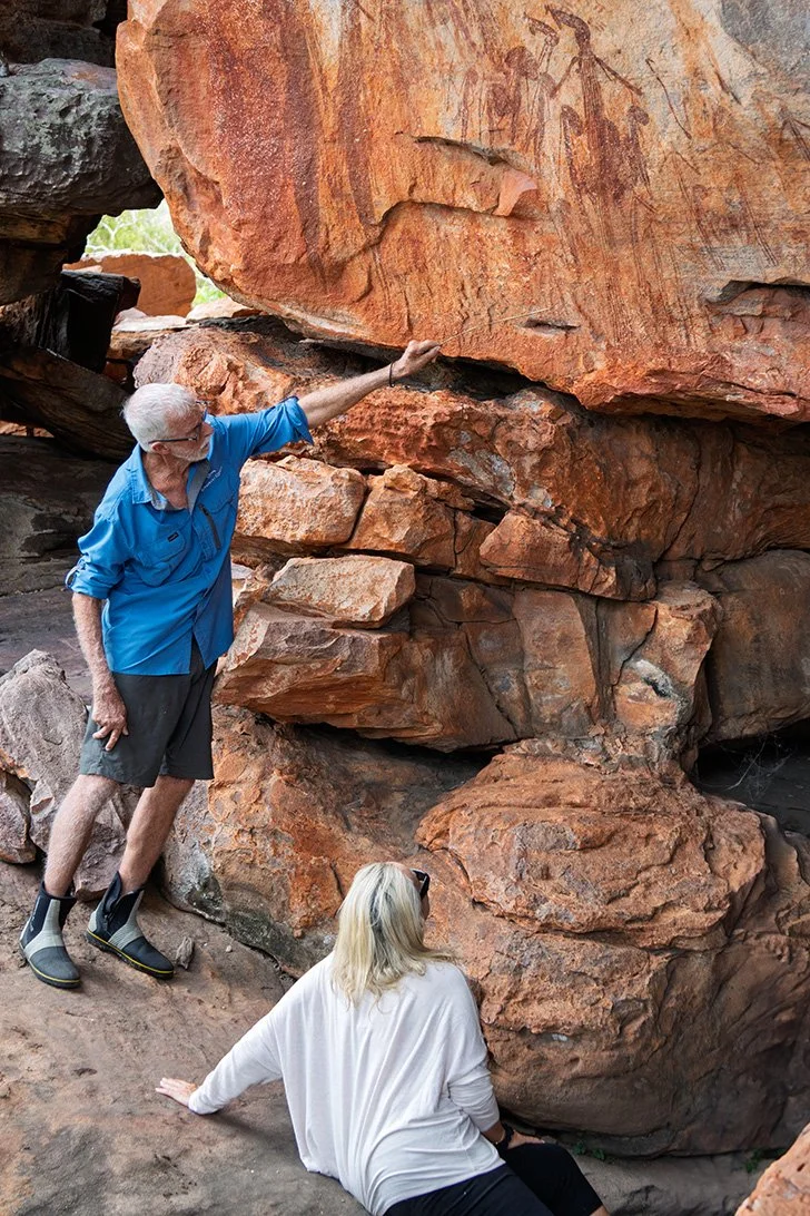
Opposite the shallow flats of Montgomery Reef lies the steep form of Raft Point rising in a bold, layered bluff that has become one of the most recognisable silhouettes of the coast. Yet its true power lies inland, in rock shelters alive with Wandjina, ancestral figures of rain and law. The Great Fish Chase and other stories painted here are not “ancient art” in the static museum sense, but part of a living law carried by Traditional Owners whose families have watched these tides for countless generations.
Collier Bay, Camden Sound & the journey to the Prince Regent River
As you track east through Collier Bay and Camden Sound, the coast feels broader, wilder again. Humpback whales use these waters as a nursery, their blows hanging briefly in the still air before dissolving into mist. Creeks carve secret corridors through mangroves and sandstone before spilling out into the sound, and every bend seems to promise either a waterfall or a crocodile – sometimes both. The journey into the St George Basin and towards the Prince Regent River finally marks the point where the southern story begins to hand the baton to the north, a rising landscape of cliffs, mountains and expansive bodies of water.
Prince Regent River & King Cascades
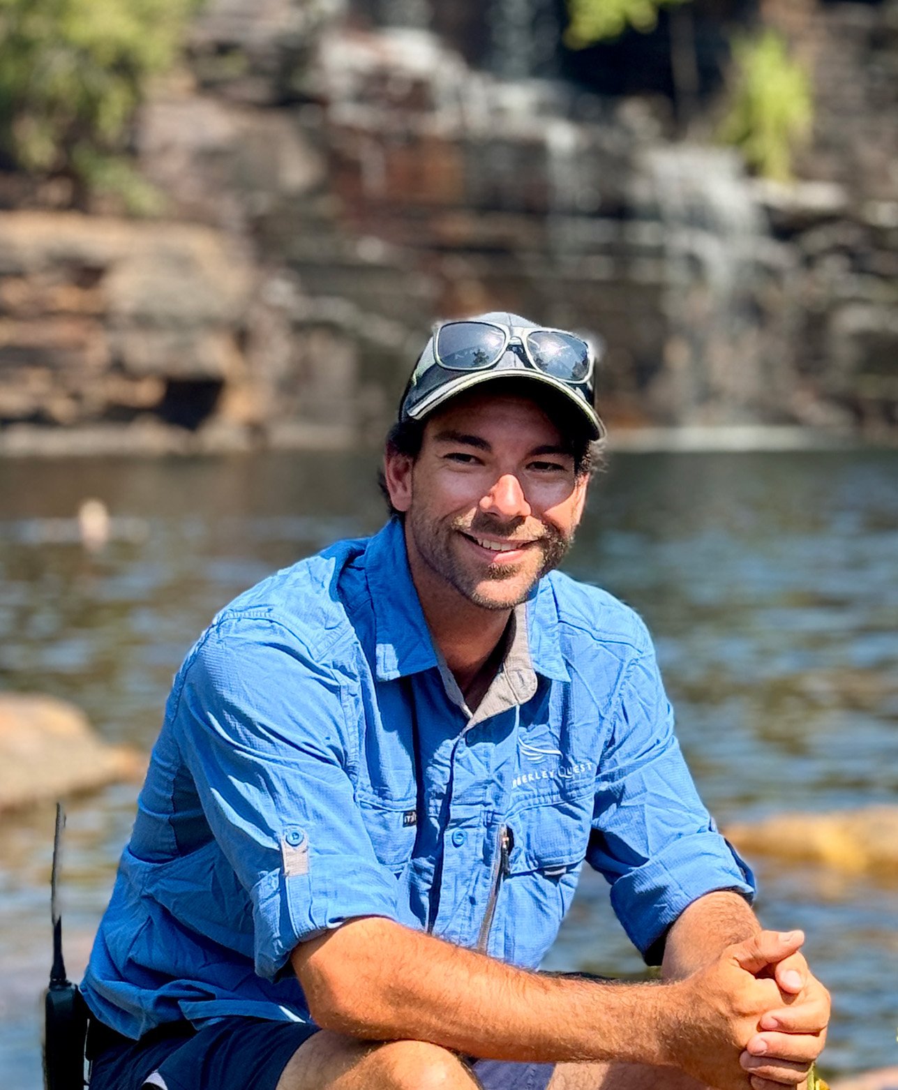
Expedition Guide - Jackson McReady
The Prince Regent River is a line of determination cut straight through the plateau; a rare, almost ruler-true watercourse that appears to have somewhere very specific to be. Tidal surges push salty water deep inland, turning bends into liquid mirrors at high tide and revealing sculpted rock shelves as the water falls away. At Kings Cascades, a sheet of water fans down a long cliff face thick with ferns and moss, a free-flowing fountain that’s been falling for longer than we can meaningfully measure.
