The Ultimate Northern Kimberley Expedition Cruise Guide
The Kimberley coast is not just a destination on a map; it is one of the last remaining wilderness areas left on Earth. Here, sheer sandstone escarpments plunge straight into the sea, rivers carve deep shadowed corridors into the plateau, and wet-season waterfalls fling themselves off the edge of the continent in torrents of white. Between Prince Frederick Harbour and the far-flung mouths of the King George and Berkeley Rivers, the coastline feels less like a series of "stops" and more like a chain of wild chapters in a single, unfolding story.
This guide focuses on that story as experienced from the sea: an expedition-style voyage between Broome and Wyndham, rather than short, isolated day trips. It is written for expeditioners who want to wake each morning to a different anchorage, a new river mouth, a fresh angle of light on the same ancient stone. Over two weeks, your vessel traces the weathered edge of the Kimberley plateau, moving from the tidal theatres of the south into the great river gorges and waterfall amphitheatres of the north.

King George Falls, the Kimberley
When to go and how long for
Kimberley Quest Onboard Naturalist, Tim Willing
Most full Kimberley expeditions run between 8 and 21 days, long enough for you to feel the shift from "holiday" to "journey". Anything shorter risks becoming a collection of highlights; allowing the places in between - the quiet bays, the unnamed headlands, the nights at anchor under a sky thick with stars - to do their slower work.
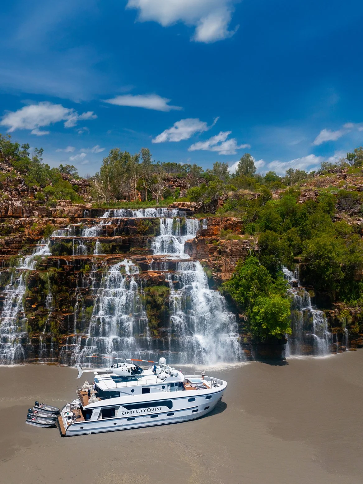
The timing of your voyage shapes the character of what you will see. At the tail end of the wet season from February and just after the wet season, typically in April and May, the country is still charged with water. Rivers like the King George, the Berkeley and the Prince Regent run strong and full; waterfalls roar from the escarpment in broad, thundering veils; and the Mitchell Plateau sends Mitchell Falls spilling down its four great tiers in a display that feels both ferocious and celebratory. This is the time for those who dream of standing in the spray at the base of a gorge, feeling the echo of falling water in their chest as much as in their ears.
As the season moves deeper into the dry, the Kimberley inhales. The big falls slender down into more delicate ribbons and streams, revealing the underlying architecture of rock that the early torrents had hidden. In return, you are given clearer air, gentler humidity, and a different kind of brilliance: long, golden afternoons that turn the sandstone to copper and the mangroves to ink-black silhouettes. The sea warms, the water runs glassy on windless mornings, and fishing for barramundi, mangrove jack and pelagic species along the headlands takes on a central place in many guests' days.
Later in the dry, usually from mid-winter onwards, another presence enters the story: humpback whales. These are the same giants that migrate along much of the Western Australian coast, but here, against the red escarpments of the northern Kimberley, their blows and breaches feel particularly dramatic. In some stretches of the voyage, their exhalations punctuate the horizon like slow, breathing metronomes.
In other words, there is no single "best" time-only different emphases. Early season is the great crescendo of water: Mitchell Falls in full voice, King George Falls at their most imposing, King Cascade thick and lush over its long, fern-clad rock face. Mid to late season offers softer days, warmer swims in secluded freshwater pools, more predictable fishing and whale-rich coastal transits. Across all months, the constants remain: the sense of isolation, the scale of the landforms, the enduring presence of Indigenous cultures and rock art that bind sea and stone into a single, continuous Country.
From here, the guide turns to the places themselves: the long, tidal sweep of Prince Frederick Harbour and the Hunter River; the straight, determined line of the Prince Regent; the remote stillness of Swift Bay and Vansittart Bay; the hidden anchorages among islands like Anderdon and Osborne; the deep-cut majesty of the King George River; and finally the dark, echoing gorge of the Berkeley. Each location is not just a dot on an itinerary, but a doorway into another facet of this remarkable northern coast. Stay with me as I attempt to take you on a journey through the north.
“You don’t simply visit the northern coast; you submit to it. The rivers decide how far you go. The tides decide when. Your job is to listen.”
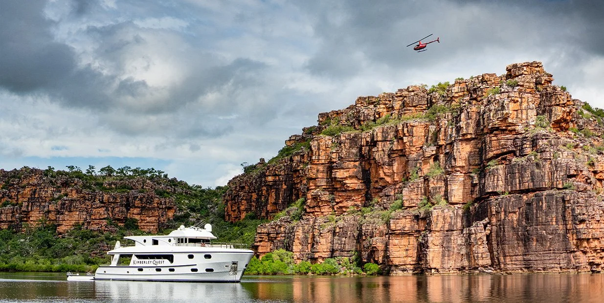
King George River, the Kimberley
From the Prince Frederick Harbour to Wyndham
If the southern coast is a threshold, the northern coast is an immersion. From Prince Frederick Harbour to Wyndham, the land seems to rise higher, the rivers cut deeper, and the sense of distance - from cities, from certainty - only grows. This is country that has never fully surrendered to the map, where each river mouth feels like the entrance to another book in the same vast library.
Prince Frederick Harbour and the Hunter River
At Prince Frederick Harbour, the coastline opens into a grand amphitheatre of headlands, each one a different note in red and creamy purple sandstone. The Hunter River snakes between mangrove banks and towering cliffs, quietly powerful, its surface occasionally broken by the armoured back of an estuarine crocodile or the sudden wingbeat of a heron lifting from the flats. The scale is such that boats seem to shrink into insignificance, tiny white marks against black-shadowed walls.
Swift Bay, Vansittart Bay and the Drysdale River
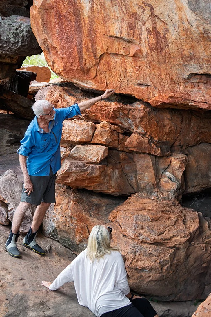
Northwards, bays like Swift Bay and Vansittart Bay feel like pauses in the coastal sentence-calmer punctuation marks between more dramatic clauses. Their quiet beaches and headlands carry traces of long human presence: stone arrangements, rock engravings, old paths now walked mostly by wallabies and shorebirds. Inland, the Drysdale River winds through rugged country that few visitors ever see, its catchments feeding remote waterfalls, billabongs and galleries of art far beyond the tidal limit. Even from the coast, you can sense the weight of that inland story pressing outwards toward the sea.
“Some of my favourite nights are spent at anchor off an island most people have never heard of. No brochure name, no postcard angle; just the sound of fish hitting the surface and the Milky Way leaning so close you feel you could drag your fingers through it.”
Anderdon Islands, Osmond/Osborne Islands and secret anchorages
Between the better-known highlights lie quieter guardians of the coast: the Anderdon Islands, the Osborne Islands, nameless rocks that hold whole histories in their shadows. These are the anchorages that don't make it into glossy brochures, the places where guides lower their voices and say, "We'll tuck in here for the night." Sea eagles patrol the updrafts, turtles surface with a soft gasp beside the hull, and the nearest streetlight is several days' steaming away.
King Cascade, the Kimberley
Winyalkan, steep silhouettes and the memory of stories
As you travel this stretch, the form of Winyalkan and other steep islands become a recurring motif on the horizon: dark, simple shapes with extraordinarily complex meanings. For local saltwater peoples, these are not just landforms but nodes in a network of story, law and responsibility that extends far beyond the visible. The traveller may not know every narrative attached to each headland and bay, but you can feel their presence like a low, steady hum beneath the wind and the engine note.
Barra Falls, Glycosmis Bay and intimate moments
In a land of grand gestures, places like Barra Falls and Glycosmis Bay offer more intimate moments. Barra Falls might be a tumble of fresh water over a ledge in the right season, a sudden brilliance of sound and spray after long stretches of still, tidal water. Glycosmis Bay can feel like the inside of a cupped hand, a gentle indentation in a stern coastline where mangroves, sand and rock share the same narrow fringe. These are the locations where guests often find their private Kimberley-less photographed, more felt.
Berkeley River, King George River and the long northern crescendo
As you near the eastern end of the voyage, the Berkeley River and King George River rise like a final crescendo. The Berkeley's high gorge walls catch the light so that the river seems to flow through liquid copper at dawn and molten gold at dusk. The King George cuts a deeper, darker incision into the plateau, culminating in twin falls that drop in sheer white veils from the escarpment, their roar echoing off rock faces that have watched countless wet seasons carve their lines deeper.
“Guests remember the big names - King George, Horizontal Falls - but years later they write to us about ‘that little waterfall after the long hot day’ or ‘the quiet bay where the dolphins turned up at dusk’. That’s the north doing what it does best: sneaking under your skin when you’re not looking.”
Finally, the coast turns inward at Cambridge Gulf, and the journey resolves itself at Wyndham. After days or weeks on the water, the sight of a town can feel almost surreal - a reminder that the modern world still exists, though the red dust on your boots and the salt in your clothes insist it can never look quite the same again.
The Kimberley coast does not rush to reveal itself. It asks for time, for tide, and for a willingness to be changed. Whether you travel the southern thresholds or the northern rivers - or, as we prefer, both - you are not simply moving through a landscape, but stepping into a living, breathing story, one that unfolds slowly and leaves a long-lasting mark on you.
